Explore CHRIS, Delaware history’s online resource
Want to learn more about Delaware history from the comfort of your own home? Then we recommend you check out Delaware’s Cultural and Historical Resources Information System (CHRIS), an online resource that provides researchers and individuals with information on Delaware’s historic places throughout the years.
From the link above, you can launch CHRIS’s interactive map of National Register-listed properties by clicking the “View Details” button. A geographical information system (GIS) mapping tool is accessible from there, with dozens of markers on the map of Delaware. The web-based mapping system allows visitors to explore historic houses and districts listed in the National Register of Historic Places as well as select National Historic Landmarks.
Each black dot on the map marks a corresponding historic site, including a description of where the property is located, type of property, related names and originating year, while properties identified with a red diamond are listed in the National Register. Links to attachments describe the property and provide photographs. Red diamonds signify locations on the Register while red circles are determined eligible for the distinction. Historic districts are outlined in red.
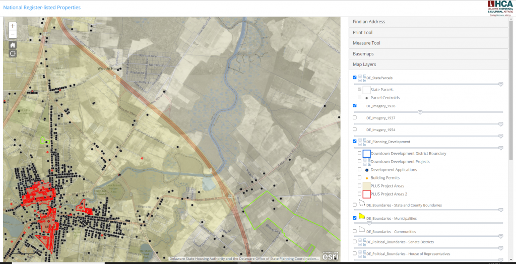
Layers appear below the map to easily filter specific searches. The base map is easily changed from topographic, streets, to satellite imagery from past years. Boundaries of surveyed areas are available to review and users can download associated survey reports. Buildings that have been surveyed and digitally mapped are in the system. Changes in the landscape are apparent through aerial photographs dating back to the 1930s compared to modern-day images.
Use the Historic Place Names layer to see historic names of places and the source of information, while the “DE Imagery” slider layers provide the same imagery as the base maps (plus 1926) but allow users to adjust the transparency of the layer to see the historic view over the underlying base map view. The “DE_Planning Development” layer allows users to view locations of currently proposed development projects and building applications.
CHRIS is an ongoing project and does not include all historical forms, reports and photos, particularly those that have not yet been digitized or added to the database. Some attachments for specific properties may not yet be available. Anyone interested in a specific property can contact Research Center Manager Jenifer Anderson-Reno at jenifer.andersonreno@delaware.gov. While not all information is public, additional services are available to cultural resource professionals conducting projects within the state. Credentialed individuals working for a state agency or contractor can request a username and password, by submitting a user account application through this link: CHRIS User Account Application.