Surveying the landscape of the ‘Delaware Wedge’
Have you ever heard of “The Wedge” in Delaware? A wedge-shaped tract of land covering nearly 800 acres between Maryland and Delaware was, for a long time, claimed by the state of Pennsylvania but governed by Delaware.
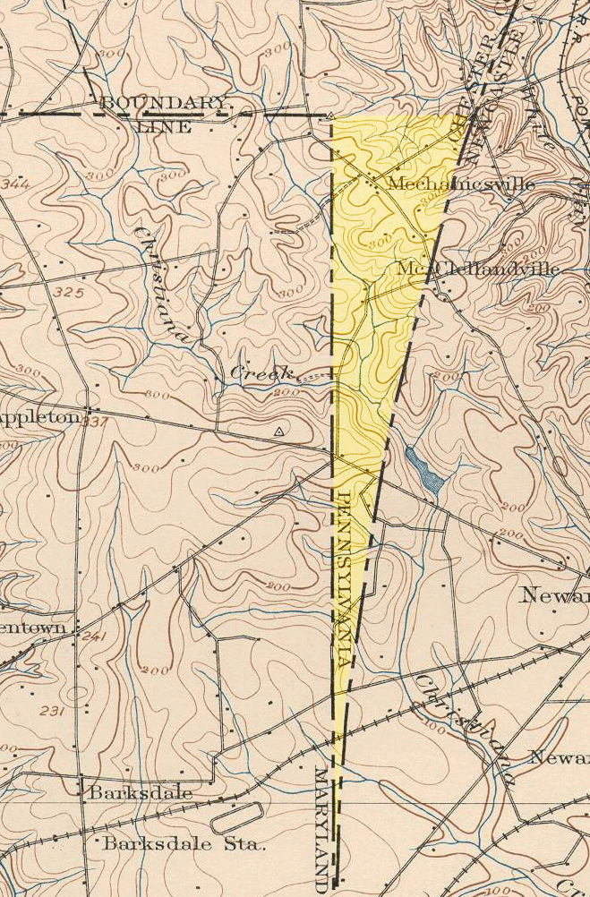
The Wedge sits just outside of the Twelve-Mile Circle and to the east of the Mason-Dixon line along the Maryland border, making it a lawless “no man’s land” for some time before governance was settled.
In 1889, a joint commission awarded the land to Delaware, a land decision that wasn’t ratified by Pennsylvania until 1897, by Delaware in 1921 and finally by Congress in 1921, according to Delaware Public Archives.
On the 100th anniversary of that recognition, New Castle County government joked about giving The Wedge back to Pennsylvania as a very historically based April Fools’ Day joke.
Learn more about the unique history of Delaware’s boundaries in this article.